Natural Borders
Natural Borders
P.O. Box 3493
Ashland, Oregon 97520
(541) 601-4797
Email
Maps -
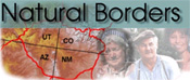
Western United States
-
Human Geographic Mapping
-
Culture/Social – Marketing
-
Trend Projections
-
Market Segments
Natural Borders is the map-making company for the JKA Group. Our maps are created using the Human Geographic Mapping method that treats the land and the people as one inseparable unit.
Why Human Geographic Mapping? Traditional geopolitical maps create arbitrary lines across the landscape. They do not reflect the natural borders created by the social, cultural, economic and ecological systems (bio-social ecosystems) of a region. Yet for effective policy and project development the land and the people who live on it must be seen, mapped and understood as one unit. You can read our policy paper on "Climate Change and the Language of Geographic Place" which makes the case that policy development based on human geographic units will make efforts to deal with climate change more effective. Human Geographic Maps depict specific bio-social ecosystems and portray the attachment people develop to each other and to the land where they live and work. Social, cultural and economic routines along with the geographic features of an area distinguish one population or cultural area from another. The importance of these maps is to see that people have habitat boundaries that do not correspond to the arbitrary boundaries that govern our formal systems. Policies and projects developed using political maps alone are not sensitive to people's attachment to the land and result in fragmented governance. Human Geographic Maps depict the people and land as one inseparable unit and are therefore highly enhanced tools for day-to-day management, long-range planning, NEPA (National Environmental Policy Act) documentation and culture-based marketing.
Cobalt Web Designs