James Kent Associates (JKA) Services Package with GSA

GS-10F-0168N
Consulting
Services (SIN 874-1)
Survey
Services (SIN 874-3)
Training
Services (SIN 874-4)
Commercial Price
List
Company
Background
Ordering
Instructions/ Terms and Conditions
Labor
Categories
Key
Search Words
SIN 874-1: Consulting Services
Description of Services
James Kent Associates has been providing services in planning and management consultation for over nearly 30 years. We are committed to citizen and organizational empowerment and we specialize in cultural alignment between institutions and the communities they serve. We have specifically helped numerous federal and county government units in strategic and action planning designed to be responsive to citizens and their interests. From the beginning point of understanding how communities function and communicate, and in understanding issues from the standpoint of citizens, JKA has facilitated in-house planning, organizational development, leadership development, and organizational assessment so that public policy outcomes represent a responsive mix of citizen and agency interests.
The specific services offered to government clients for this SIN include the following:
- Social, economic, and cultural compliance with the National Environmental Policy Act (NEPA). Focusing on Section 101, the policy section calling for “Productive Harmony” between human and physical environments, allows a streamlined, more efficient way to handle the compliance required by Section 102. Our work includes the issue scoping, assessment of baseline conditions, alternative development, analysis and mitigation opportunities from the standpoint of community members affected by federal decision-making.
- Project Troubleshooting. JKA is adept at creating optimal conditions for discussion and consideration of public agency initiatives. Too often, such proposals polarize quickly, and rather than a fair process based on the merits of the proposal, it is debated on the basis of rhetoric, emotion and distortion (“Jobs versus Owls”). By working at the informal levels of community through social networks, key individuals and people that have the issues are communicated with and their interests are used to shape project design. Public aspects of the process are handled strategically to emerge from the grassroots in a way that creates community ownership. For example, when the National Park Service and the Bureau of Land Management proposed a multi-use park on the Middle Snake River Canyon near Twin Falls Idaho in 2001, local newspapers characterizing it as “big government” began to dominate the public discourse. When the public process was slowed and time given for informal network contact, key interests in the park were identified which began to shape and develop the proposal. When the proposal went public, NPS and BLM were on the sidelines, while local citizen groups spearheaded the proposal, leading to approval.
- Community-Based Land Use Planning. For National Forest Plan revisions and for revisions of Resource Management Plans (RMPs) of the Bureau of Land Management, as well as the planning requirements of other government agencies, JKA is adept at a cultural approach to create community-based planning processes. A social, economic, and cultural description of an area, the identification of communication patterns, major citizen issues, and opportunities for communication and action are structured to create responsive planning capable of engendering broad-based support for the planning product.
- The Application of Human-Geographic Mapping to GIS (geographic information systems). Human geographic mapping shows graphically how people relate and identify with their landscape, and how they distinguish one population from another. JKA maps these perceptions at seven scales of geography from neighborhoods to cultural units. The mapping is useful for planning purposes, for public involvement programs, and for the documentation necessary for NEPA compliance. GIS technology for the first time allows social and cultural data to be treated as conceptual partners with biophysical data to create a true bio-social approach to ecosystem management.
- Organizational and Project Assessment and Evaluation: organizational change and staff development necessary to implement a management program responsive to community interests.
- JKA also offers the training courses of SIN 874-4 that are specifically tailored to local situations and preferences. These are described more fully under SIN 474-4:
Executive Seminar in Social Ecology and Public Policy; 1.5 days
The Discovery Process™; 3 days
Human Geographic Mapping; 4.5 days
Discovery Weeklong; 5 days
Case Example One
Citizen Issues and Opportunities in Addressing Oil and Gas Industry Impacts in Farmington, New Mexico for the BLM Field Office: Assistance in Creating a Revised Resource Management Plan (RMP), 2002
JKA was contracted to assist the Farmington Field Office of the BLM to identify citizen issues and opportunities related to BLM land use management. Because of the polarized, controversial nature of oil and gas development presently in the San Juan Basin, it was expected that public meetings would not be a productive way to gauge citizen interests. Instead, JKA utilized its Discovery Process™ to “enter the routines” of the community in order to identify informal networks, traditional patterns of communication, and citizen interests related to oil and gas development, recreation, land ownership tenure, and other aspects of federal land management.
The Discovery Process yielded rich information. With regard to oil and gas development, citizens were concerned about compressor noise, impacts on water sources and wildlife, impacts on agricultural operations, and concerned about inadequate compliance with existing regulation. Recreationists reported increasing conflict between different types of recreation users on public lands, increasing economic importance of visiting recreationists in the area, and numerous management ideas for addressing citizen issues. Faced with steady to rapid growth, regional leadership was very interested in land ownership tenure and the role of BLM decisions through the RMP process in fostering responsible growth.
Not only was this information identified, but the specific issue holders as well. A communication strategy was developed and implemented in conjunction with BLM that led the way to significant reform in oil and gas management, a community-based recreation plan, and a citizen-centered land tenure alternative.
The documentation of citizen issues and opportunities was important not only for management but for the environmental impact statement process, as required by the National Environmental Policy Act (NEPA), as well as the revised land use plan (the Resource Management Plan) which authorizes management decisions. Hence, the JKA work served to inform the NEPA process in terms of scoping, alternative development, analysis and mitigations.
The Farmington Project began October 28, 2000 and was completed by June1, 2001. The contact for the Farmington work is Steve Henke, Field Office Manager; 505-599-6340; Bureau of Land Management, 1235 La Plata Highway, Farmington, NM 87401.
Review at: JKA Publications.
Related Work: The following is a list of similar work JKA has performed in the last two years for federal and local government units:
- Phoenix BLM Field Office, community-based planning and collaboration for new Resource Management Plan (RMP); Chris Horyza; 623-580-5628. Timeframe: 1999-2003.
- Research and Action Planning for Economic Development in the Illinois Valley, Oregon. Illinois Valley Community Response Team; Vinnie Danke, 541-592-4440. Timeframe: 2000.
- A Community-Based Evaluation of the Community Response Team, Wolf Creek, Oregon, Sunny Wolf Community Response Team. Louise Dix, 541-774-2090. Timeline: 2000.
- Integrated Resource Management for a Proposed Multi-Use Park in South-Central Idaho, Shoshone BLM Field Office and the Hagerman Fossil Beds National Monument (National Park Service). Neil King, Hagerman Fossil Beds, National Park Service; Phone: 208-837-4793. Timeline: 2000.
- The Implementation of First Social Capital Policy at the Municipal Level; Tom Baker, Basalt Town Manager, Basalt, Colorado; Phone: 970-927-4701. Timeline: 2002.
Case Example Two
The development of citizen-oriented design in a land use planning case on the Big Island, Hawaii, 2008.
JKA assisted Midland Pacific Homes to create citizen-oriented design on the Kona Coast of Hawaii Island. West Hawaii is the setting of intensive development pressures. Not only are real estate prices some of the highest in the country, but government does not often keep up with the impacts created by development. Moreover, development occurs in the context of differences in economic standing and ethnicity, so it appears to many people that there are winners and losers with development. Indeed, the displacement of native Hawaiians from their own homeland is a very real occurrence and reflects the gap between the “haves” and “have not’s” that is probably as wide as anywhere in the U.S.
In this setting of strong anti-development attitudes, working through informal networks grounded in the culture of their communities was essential. While citizens initially reacted with skepticism about the goal, over time, they became enthusiastic participants in shifting the design from traditional “California” style development (golf course, gated communities, private beach club) to a pedestrian-oriented village for island residents, with local and protected beach access, trail systems, practical shopping and affordable housing.
Case Example Three
A Visioning Process for Grand Junction and Mesa County, Colorado, 2001.
Mesa County and Grand Junction, Colorado, through what is called The Valley Vision 2020 Steering Committee, desired to undertake a visioning process in the region that would offer guidance to a strategic plan and to the decision-making of individual government units. The 2020 Committee commissioned JKA to do this work because it wanted a cultural methodology that included direct citizen contact and sensitivity to geographic diversity.
Beginning In February, 2001, JKA engaged in the Discovery Process to assess Seven Cultural Descriptors: publics, networks, settlement patterns, work routines, supporting services, recreational activities, and geographic boundaries. The methodology involved scales of effort that began with community description, progressed to neighborhood chat sessions and village gatherings, and culminated in a valley-wide celebration of the results. What the work revealed is that at the individual and community level there were strengths within the community that were shared and that led to successful adaptation to changing conditions. The social capital—those enduring norms of trust and reciprocity—was central to numerous stories of people coming together and solving their own problems. A pivotal factor in the cultural development of the Grand Valley was the historic geographic isolation of the area. The three personal strengths—resilience, self-sufficiency, and caretaking—were related to the key community strengths—absorption, adaptability, and stabilization. Through people telling their own stories of why they came to the Valley, why they stayed, and what they needed to continue to stay, a composite picture emerged of the vision residents had for their community.
Both strategies and “alignment actions” emerged from the citizen process. The strategies were five:
- Honor civic protocols, the unique and preferred forms of communication in each geographic area;
- Build capacity, or the ability of individuals, networks and groups to create, participate in, and absorb events that affect one’s life;
- Develop social capital, when citizens engage the events and issues that surround them in a manner that produces confidence, caretaking, equity, choice, and cohesiveness;
- Enhance diversity, in the social, economic and natural environments;
- Ensure predictability, or the ability to anticipate and plan for the future.
Alignment actions refer to the relationship between intention and action and between citizens and the institutions created to serve them. The identified action levels were:
- Remove barriers: pick low hanging fruit. In reference to the historical ties to orchards, residents wanted emerging issues resolved by leadership in an ongoing way; the presence of these issues served to block citizen attention in addressing longer-term or more complex issues;
- Generate momentum by supporting citizens in resolving issues.
- Engage citizen participation through cooperative endeavors. Successes of the past were still told in stories to create present vision.
- Integrate citizen ownership through stewardship activities. The notion is to foster empowerment and capacity within citizens to solve their own issues, while government takes a facilitative function rather than regulatory function.
This work was begun February, 2000 and was completed in August, 2001. The JKA work culminated in a report entitled, “The Grand Valley: A Community Vision for the Year 2020,” presented to The Valley Vision 2020 Steering Committee, August, 2001. The contact with this work is the Chair of the 2020 Visioning Committee, Brian Mahoney, (970) 243-3421.
Description of Services
Survey Services refer to the planning and implementation of inquiry methodologies to learn about social, economic, and cultural aspects of community life. Methodologies not only have to be credible but the results must be meaningful. That is, decision-makers must know that the methodologies are replicable by others, they are systematically implemented, and the results interpreted fairly according to some standard. Survey services include discussions with the client to clarify objectives and content, review work to date, and refine the program of work as necessary.
JKA specializes in qualitative social science methodology designed to meet a variety of objectives, including: 1) identifying citizen issues at emerging, existing, and disruptive stages of development, and the development of management response and public policy formation; 2) community assessment, in order to anticipate social and economic effects from alternative courses of action and to document current conditions for NEPA-related (National Environmental Policy Act) purposes; 3) the development of communication strategies for ongoing relationship-building and dialogue.
Traditionally, qualitative methodologies are not considered very scientifically rigorous. Statistical methodologies can offer assurances based on probability theory that the true range of variation approximates the observed range of variation. For example, the range of public opinion related to a public policy choice can be determined for a given population. However, what these methodologies offer in rigor, they lose in application and meaning. Hence, a survey does not offer guidance in how to work with people in order to create public policy with broad public support, nor is the meaning surrounding the opinion often determined because of the fixed wording required by statistical surveys.
JKA’s methodology is known as the Discovery Process™ whereby field workers “enter the routines” of the community, making observations and engaging in conversations with residents until the “inside point of view” becomes clear. The objectives of the Discovery Process are to determine how local communities are actually functioning, what is important currently in community life, who are the well-regarded network caretakers valued by others, how communication happens, and the local social and economic trends most observed by actual residents. Although the statistical rigor of such an approach is low, it is a method that is nonetheless very systematic, broad-based, and scientific. In the view of JKA, the results are much more useful: 1) citizen issues are tied to the people that carry the issue, enabling a collaborative process of joint problem solving; 2) issues are identified as stages of development—emerging, existing, and disruptive—so that management attention is appropriately targeted; 3) they inform quantitative data gathering so that it is more efficient and useful. For example, residents often point out trends 5-7 years before they show up in statistics, so for conducting environmental impact statements or similar efforts, the quantitative data gathering is targeted and the analysis more relevant. JKA has a thirty year history in applying the Discovery Process to the needs of its government clients.
The specific services of JKA under this SIN are:
- Social and economic assessment
- Qualitative survey methodology, based on ethnography and Discovery Process™
- Community sampling for citizen issues and opportunities
- Citizen surveys, opportunities for early conflict resolution to avoid mediation
Case Example One
Issues and Opportunities Related to Public Land Management of the Bureau of Land Management (BLM) offices in Baker and Prineville, Oregon, 2007.
Community fieldwork was undertaken in ten counties in northeast Oregon and one county in southwest Washington in order to identify issues and opportunities from citizens related to public land management. Informal networks and communication pathways were identified and accessed to understand local community functioning. Citizen issues were scoped for intensity (emerging, existing, disruptive), extent (isolated, local, regional), and duration (immediate, short term, long term). Human geographic units were developed throughout the region and communication strategies for each area to promote ongoing discussions between residents and BLM regarding land use planning direction.
Two reports were filed, both located on our website:
- “Community Reports in Support of the Planning Effort in BLM’s
Baker Resource Area,” submitted to the Baker Resource Area Office
of the BLM. Review at:
JKA Publications. - “Community Reports and Scoping Support Document for the BLM Planning
Effort in the John Day River Basin,” submitted to the Central Oregon
Resource Area Office of the BLM. Review at:
JKA Publications.
Case Example Two
Identification of Citizen Issues and Opportunities to Create Community Benefit from Habitat Restoration, Ft. Bragg, North Carolina. U.S. Fish and Wildlife Service; Peter Campbell; (910) 695-3323. Timeline: 2000. Review at: JKA Publications.
Case Example Three
Kootenai River Indian Tribe, identification of opportunities for collaborative watershed restoration; Adriane Borgias; (509) 892-0041. Timeline: 2000. Review at: JKA Publications.
SIN 874-4: Training ServicesDescription of Services
JKA has specialized in planning and management training for over 30 years with both standardized and custom-tailored courses. Our principle objective is to foster alignment between government units and local communities. We call Social Ecology the process of creating productive harmony between human and natural environments. Productive harmony is a concept put forward by Section 101 of the National Environmental Policy Act (NEPA), the environmental law of the land that directs federal government agencies to create a balance in their decision making. Social Ecology occurs in two steps, the Discovery Process™ and the Human Geographic Issue Management System.™--the first is designed for community assessment and the second is the design of management systems integrating community interests and issues found in the Discovery Process. Each will be described in turn.
The Discovery Process in a means to “enter the routines” of the community, so that, through direct contact, field workers understand how the community is functioning, what is important, who communicates with whom, who is well-regarded by others as a caretaker, and the current social and economic trends. Of particular importance is identifying the informal social networks by which people sustain themselves at the grassroots level. The networks form the basis of caretaking and reveal the location of change and adaptation at the local level. The Discovery Process is based on Seven Cultural Descriptors :
1. Publics: Segments of the population or a group of people having common characteristics, interests, or some recognized demographic feature. Sample publics include agriculturalists, governmental bodies, homemakers, industries, landowners, loggers, miners, minorities, newcomers, preservationists, recreationalists, senior citizens, small businesses and youth.
2. Networks: A structured arrangement of individuals who support each other in predictable ways because of their commitment to a common purpose, their shared activities, or similar attitudes. there are two types of networks, those that are informal arrangements of individuals who join together as a way to express their interests, and those that are formal arrangements of individuals who belong to an organization to represent their interests. Networks functioning locally as well as those influencing management from regional or national levels are included in this descriptor. Examples of citizen networks include ranchers who assist each other in times of need, grassroots environmentalists with a common cause, or families who recreate together. Examples of formal organizations include a cattlemen’s association, or a recreational club. sides and the type of settlement categorized by its centralized/dispersed, permanent/temporary, and year-round/seasonal characteristics. It also describes the major historical growth/non-growth cycles and the reasons for each successive wave of settlement.
3. Settlement Patterns: Any distinguishable distribution of a population in a geographic area, including the historical cycles of settlement in an area. This cultural descriptor identifies where a population is located and the type of settlement categorized by its centralized/dispersed, permanent/temporary, and year-round/seasonal characteristics. It also describes the major historical growth/non-growth cycles and the reasons for each successive wave of settlement.
4. Work Routines: The ways in which people earn a living, including where and how. The types of employment, the skills needed, the wage levels, and the natural resources required in the process are used to generate a profile of a population’s work routines. The opportunities for advancement, the business ownership pattern and the stability of employment activities are also elements of this descriptor.
5. Supporting Services: Any arrangement people use for taking care of each other, including the institutions serving a community and the caretaking activities of individuals. This descriptor emphasizes how supporting services and activities are provided. Commercial businesses, religious institutions, social welfare agencies, governmental organizations, and educational, medical and municipal facilities are all examples of support services. Caretaking activities include the ways people manage on a day-to-day basis using family, neighborhood, friendship or any other support system.
6. Recreational Activities: The way in which people use their leisure time. The recreational opportunities available, seasonality of activities, technologies involved, and money and time required are aspects of this descriptor. The frequency of local/non-local uses of recreational resources, the preferences of local/non-local users, and the location of the activities are also included.
7. Geographic Boundaries: Any unique physical feature that defines the extent of a population’s routine activities. Physical features generally separate the cultural identity and daily activity of a population from those living in other geographic areas. Geographic boundaries include geologic, biologic, and climatic features, distances, or any other characteristic that distinguishes one area from another. Examples of geographic boundaries include topographic features that isolate mountain valleys, distances that separate rural towns, or river basins that shape an agricultural way of life. Geographic boundaries may be relatively permanent or short-lived; over time, boundaries may dissolve as new settlement patterns develop and physical access to an area changes.
Human Geographic Issue Management Systems (HGIMS) are designed to shape a management system around the dynamics discovered in the community so that alignment between government units and citizens can be achieved. Major tools to accomplish this objective are human geographic maps, one of the products of the Discovery Process. Human geographic maps reveal the identity people have with their natural landscape and are determined by the Seven Cultural Descriptors, described above. JKA in recent years has applied HGIMS to GIS (geographic information systems) applications. County government in Washoe County, Nevada, for example, had an Issue Management program for 8 years that utilized a GIS application. In natural resource management, GIS offers a way to bring social, economic, and cultural information on an equal level to the bio-physical information that is typically displayed, for the first time, creating the capacity for truly an integrated resource management.
Training Course |
Executive Seminar in Social Ecology and
Public Policy |
The Discovery Process™ |
Human Geographic Mapping |
Discovery Weeklong |
Case Example One
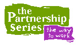
JKA’s principals are instructors with the Bureau of Land Management’s National Training Center (NTC). We utilize the principles of Social Ecology and Public Policy in two of the five courses the Training Center offers in “The Partnership Series”-- “Community-Based Partnerships” and “Learning Community: Linking People, Place and Perspective.” We are also instructors in Social Ecology and Public Policy for other courses of the NTC that are not tied to the Partnership Series. These include “Planning Concepts,” a course for the many BLM Field Offices undertaking land use planning efforts in the next few years, and “Pipeline Projects: Assessment and Implementation”, a course outlining strategies for public involvement and responsive management for pipeline development.
Our involvement in the Partnership Series of the National Training Center has dated from 5 years ago and is still going on. The National Training Center’s director of the Partnership Series in Phoenix is Mr. Charles Pregler, (602) 906-5504.
Case Example Two
JKA also undertakes several training programs under its own company auspices. Primary among them are training programs in The Discovery Process™, Discovery Weeklong, and Human Geographic Mapping.
The Discovery Process training was offered for the Phoenix Field Office of the BLM. Participants were introduced to the methods of community assessment and citizen issue identification, and they participated in a community fieldwork exercise. The contact for this course is Chris Horyza, Community Liaison and Planning Coordinator, Phoenix BLM Field Office, (623) 580-5628.
Discovery Weeklong training was offered for the Yuma and Arizona Strip Field Offices of the BLM. In these courses, BLM staff were instructed in methods of community assessment and fieldwork and then guided through a process of community Discovery over a period of a week’s time. For Yuma, the outcome was a report on citizen interests and issues that has helped shape the Preparation Plan for revising their Resource Management Plan (RMP). For the Arizona Strip, the outcome was a broadened scoping process for their land use planning plus a communication strategy for maintaining ongoing dialogue based on geographic area. Contacts for the Discovery Weeklong training are: a) Gail Acheson, Yuma Field Office Manager, (520) 317-3200 b) Diana Hawks, Planning Coordinator, Arizona Strip Field Office, BLM, (435) 688-3266.
The Willamette National Forest has undertaken training in Human Geographic Mapping beginning in January, 2002. Ten people have been trained in the methodology and the community assessment process is now complete. The final product is a set of human geographic maps at three scales with attached databases related to social, economic, and cultural aspects of local life. This material is formatted into a GIS (geographic information system) model, in which a social/cultural overlay for the first time is on equal footing with the bio-physical data usually displayed in GIS. The outcome is a highly-enhanced management tool useful for day-to-day management, long-range planning, and NEPA (National Environmental Policy Act) documentation. Central to the final product is a set of communication strategies based on geographic diversity through which to sustain citizen relationships.
Contact for the Human Geographic Mapping Training is Patti Rodgers, Public Affairs Officer, Willamette National Forest, (541) 225-6305. Human Geographic Mapping was also conducted in Central Oregon, Deschutes and Ochoco National Forests and Prineville BLM Field Office (Central Oregon Initiative of Service First); Tina Welch, (541) 416-6731. Timeline: 2000.
Commercial Price List
For Consulting and Survey Services (SIN 874-1, 874-3), JKA uses the principles of Social Ecology to create productive harmony between the human and physical environments, as called for in Section 101 of the National Environmental Policy Act (NEPA). For federal requirements having to do with public involvement, public participation programs, community assessments, social and economic assessments, environmental impact statements, preparation plans, land use planning, facilitation, partnerships, management consultation, and management training, JKA can assist by working within existing local cultures to achieve collaborative, community-based ecosystem stewardship. Related management aspects of team building, organizational assessment, action planning, community surveys, and analysis of quantitative and qualitative social/economic survey data are included as well. These services are contracted for at the rates quoted below.
Labor Categories |
Commercial Daily Rate |
Government Daily Rate |
Lowered Rate in Accordance with Modification FX-03 (less 0.25%) |
Principal In Charge |
$1320 |
$1200 |
$1197 |
Senior Strategist |
$1320 |
$1200 |
$1197 |
Project Manager |
$1120 |
$1000 |
$997.50 |
Field Worker |
$ 880 |
$ 800 |
$798 |
Research Associate |
$ 880 |
$ 800 |
$798 |
Data Analyst |
$ 752 |
$ 700 |
$698.25 |
Training Services (Sin 874-4)
| Course Offerings | Commercial Rates |
Government Rates |
Lowered Rate in Accordance with Modification FS-03 (less 0.25%) |
Executive Seminar in Social |
$14,000 |
$10,500 |
$10,473 |
The Discovery Process™ |
$19,500 |
$15,200 |
$15,162 |
Human Geographic Mapping |
$21,000 |
$16,000 |
$15,960 |
Discovery Weeklong |
$22,000 |
$16,500 |
$16,458 |
SIN NUMBER 874-4 Cost Length Min # Max #
Executive Seminar in Social Ecology and Public Policy $12,000.00 1.5
days 15 24
Price per participant over minimum is $800.00
Executive orientation to social ecology and public policy. Drawing on the “productive
harmony” directive of the National Environmental Policy Act (NEPA), participants
learn methods to create cultural alignment between institutions and the communities
they serve through the Discovery Process and Human Geographic Issue Management
systems (HGIMS).
The Discovery Process $18,000.00 2.5
days 24 30
Price per participant over minimum is $750.00
The Discovery Process is a means to “enter the routines” of a community
so that citizen issues, informal networks, gathering places, caretakers, and
social and economic trends may be identified. This information is useful, not
only for planning and NEPA documentation, but issues at the emerging stage
of development may be targeted for management attention.
Human Geographic Mapping $19,500.00 3
days 15 18
Price per participant over minimum is $1300.00
Human Geographic Mapping is a method of research designed to describe human
culture. Using seven Cultural Descriptors, the workings of local communities
are identified, documenting social and economic conditions, citizen issues
related to natural resource management, opportunities for responsive management
practice and communication strategies tailored to geographic areas. Products
are GIS ready.
Discovery Weeklong $21,000.00 4.75
days 14 16
Price per participant over minimum $1500.00
This course uses the Discovery Process to develop staff capacity for issue
management and ongoing citizen contact. By “entering the routines” of
the community, specific measures for identifying citizen issues are developed,
resulting in communication strategies sensitive to social and geographic diversity.
On January 6, 2003, James Kent Associates (JKA) was awarded a contract (#GS-10F-0168N) from the General Services Administration (GSA) to assist the government in management and organizational development. Using our trademarked approaches, The Discovery Process™ and the Human Geographic Issue Management System™, we assist government agencies to create collaborative, community-based, and citizen-oriented approaches to policy and program development. Our approaches are embodied in a Social Ecology [1] theory of governance whose goal is “fostering Productive Harmony between human and physical environments,” as called for in the National Environmental Policy Act (NEPA).[2]
James Kent Associates has developed and refined a methodology over the years that allows a community and the proponent of an action to benefit mutually from proposed change. In more than 200 communities where we have worked with these techniques, we have been able to prevent, manage, and/or reconcile disputes in a manner that has enhanced the quality of the project and of the community. Projects have included environmental assessments, environmental impact statements, public involvement programs and strategic plans for proposed ski areas, resorts, airports, mines, housing projects, industrial parks, golf courses, power generating facilities, etc. We have experience with the National Environmental Policy Act (NEPA), Superfund and other federal compliance laws.
It is our observation that most proposed projects that run into trouble, fall behind schedule and generate political opposition, may technically comply with legal requirements and with public involvement requirements. But they fail to discover the real issues that exist in the community that are held by the people who don’t come to the meetings. Project proponents must understand that an informal communication system exists in every community, and that all of the networks in every community carry issues. Some of these issues are not affected by the proposed action, but some are adversely affected. And, if the proposed action neglects to take this reality into account, the proposed projects can get bogged down, often at the last minute. Even in the project is approved, the results are often disastrous to the local culture of the community. Our process takes these factors into account early and creates an environment amenable to resolving conflicts that is culturally sensitive.
The approach we have used in a variety of urban and rural communities, including international settings, has several major facets:
- It is geographically-oriented.
We analyze present and historic settlement patterns. We use seven cultural
descriptors to define neighborhoods, villages, and rural areas.
- It
is issue based. We identify and categorize public issues as emerging, existing
or disruptive. Issues can then be acted upon in a timely, appropriate manner.
- It includes monitoring the ways in which opinions on public issues become formed. Of special importance are the informal channels of communication by citizens at the neighborhood level, not just the formal organizations and the media. The public issues that are discovered are linked to the informal groups that carry the issues.
Our system works in a variety of localities with different cultural, social and economic conditions. We identify grassroots networks and are thereby able to provide information from an appropriate cultural perspective that is used in developing strategies and policies for our clients. Present and former clients are listed below.
Schedule for: Management, Organizational and Business Improvement Services (MOBIS)
Federal Supply Group: 874 Class: R499
Contract Number: GS-10F-0168N
Contract Period: December 23, 2002 through December 22, 2007
Contractor:
James Kent Associates
837 Steele Street
Denver, Colorado 80206
Telephone: (541) 601-4797
Fax: (541) 552-9683
Web Site: www.jkagroup.com
E-mail: kpreister@jkagroup.com
Contract Administrator: Kevin Preister
Customer Information
1. Table of Awarded Special Item Number(s): 874-1; 874-3; 874-4;
2. Maximum Order: $1,000,000.00
3. Minimum Order: $300.00
4. Geographic Coverage: Domestic and Overseas
5. Points of production: same as company address.
6. Discount from list prices or statement of net price: Government net prices (discounts already deducted).
7. Quantity discounts: none offered.
8. Prompt payment terms: Net 30 days.
9. Notification that Government purchase cards are accepted at or below the micro-purchase threshold: Yes.
9b. Notification whether Government purchase cards are accepted or not accepted above the micro-purchase thresholds: Will not Accept Over $2,500.
10. Foreign items: None
11a. Time of Delivery: Specified on the Task Order.
11b. Expedited Delivery: Contact Contractor.
11c. Overnight and 2-day delivery: Contact Contractor.
11d. Urgent Requirements. Contact Contractor.
11. F.O.B. Points: Destination.
13a. Ordering Address: Same as Company Address.
13b. Ordering procedures: For supplies and services, the ordering procedures, information on Blanket Purchase Agreements (BPA’s), and a sample BPA can be found at the GSA/FSS Schedule page (http://www.gsa.gov/portal/content/199353).
14. Payment Address: Same as company address.
15. Warranty Provision: Contractor’s standard commercial warranty.
16-24: Not applicable.
25. Data Universal Numbering System (DUNS) number: 04-8112242
26. Notification regarding registration in Central Contractor Registration (CCR) database: Registered.
Principal-in-Charge: the person responsible for timely completion of tasks, interaction with the client to develop and refine the scope of work and timeline as needed, supervision of team members, and administration.
Senior Strategist: an associate with twenty-five or more years experience in the field to advise JKA on management strategies capable of accomplishing client objectives.
Project Manager:a senior associate with responsibility for day-to-day management of project, accomplishment of specified work tasks, and supervision of subordinates.
Field workers: trained sociologists, anthropologists, and other social scientists with responsibility to conduct community-based research to accomplish task order objectives.
Research Associate:trained sociologists, anthropologists and other social scientists with responsibility to collect statistical, secondary, and other quantitative data related to task order objectives.
Data Analyst: statistician and GIS-trained (Geographic Information System) technical, with responsibility to assist in data interpretation and formatting.
Key Search Words: Public Involvement, Community Development, Partnership Formation, Community-Based Approaches, the Discovery Process, Issue Management, Human Geographic Mapping, NEPA Compliance, Productive Harmony, Community Assessment, Social and Economic Assessment, Community-Based Collaborative Stewardship.
Kent, James A., J.D., Kevin
Preister, Ph.D., “Methods for the Development of Human Geographic Boundaries
and Their Uses”, in partial completion of Cooperative Agreement No.
1422-P850-A8-0015 between James Kent Associates and the U.S. Department of
the Interior, Bureau of Land Management (BLM), Task Order No. 001, 1999.
Review at:
JKA Publications.
Cobalt Web Designs